Pulu Indigenous Protected Area (IPA)
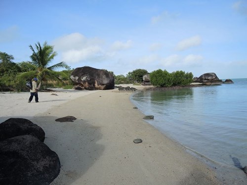
Pulu Indigenous Protected Area (IPA) is located off the western shore of Lag Mabuyag (Mabuyag Island) in the center of the Torres Strait, the waterway separating mainland Australias Cape York peninsula from Papua New Guinea. Lag Pulu (Pulu Islet), is small at only 15Ha in size, however, Pulu and its surrounding islands are the cultural stronghold for the Goelmulgal (the people of nearby Lag Mabuyag/ Mabuyag Island).
Lag Pulu (Pulu Islet) was declared an Indigenous Protected Area due to its immense cultural significance for Goemulgal. Pulu is one of the oldest archaeological sites in the Torres Strait. Archaeological excavations in rock shelters and caves on Pulu have uncovered pottery dating back from 1700 to possibly 2500 years ago. Made from western Torres Strait clays, it is Indigenous Australia’s first known pottery tradition.
Lag Pulu (Pulu Islet) is surrounded by rich sea country, where extensive reefs and seagrass beds provide significant habitat for Dhangal (Dugong), Kaiyar (Painted Rock Lobster) and large populations of foraging Waru (Green turtle).
When was our IPA Declared?
Pulu Islet IPA was declared in 2009 after a decade of planning and negotiation between the Goelmulgal (Mabuyag people), the Torres Strait Regional Authority (TSRA) and other government agencies.
Where is Pulu IPA Located?
Pulu Indigenous Protected Area (IPA) is located in the near-western islands of the central Torres Strait, approximately halfway between the tip of mainland Australia and Papua New Guinea.
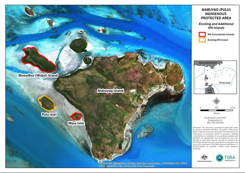
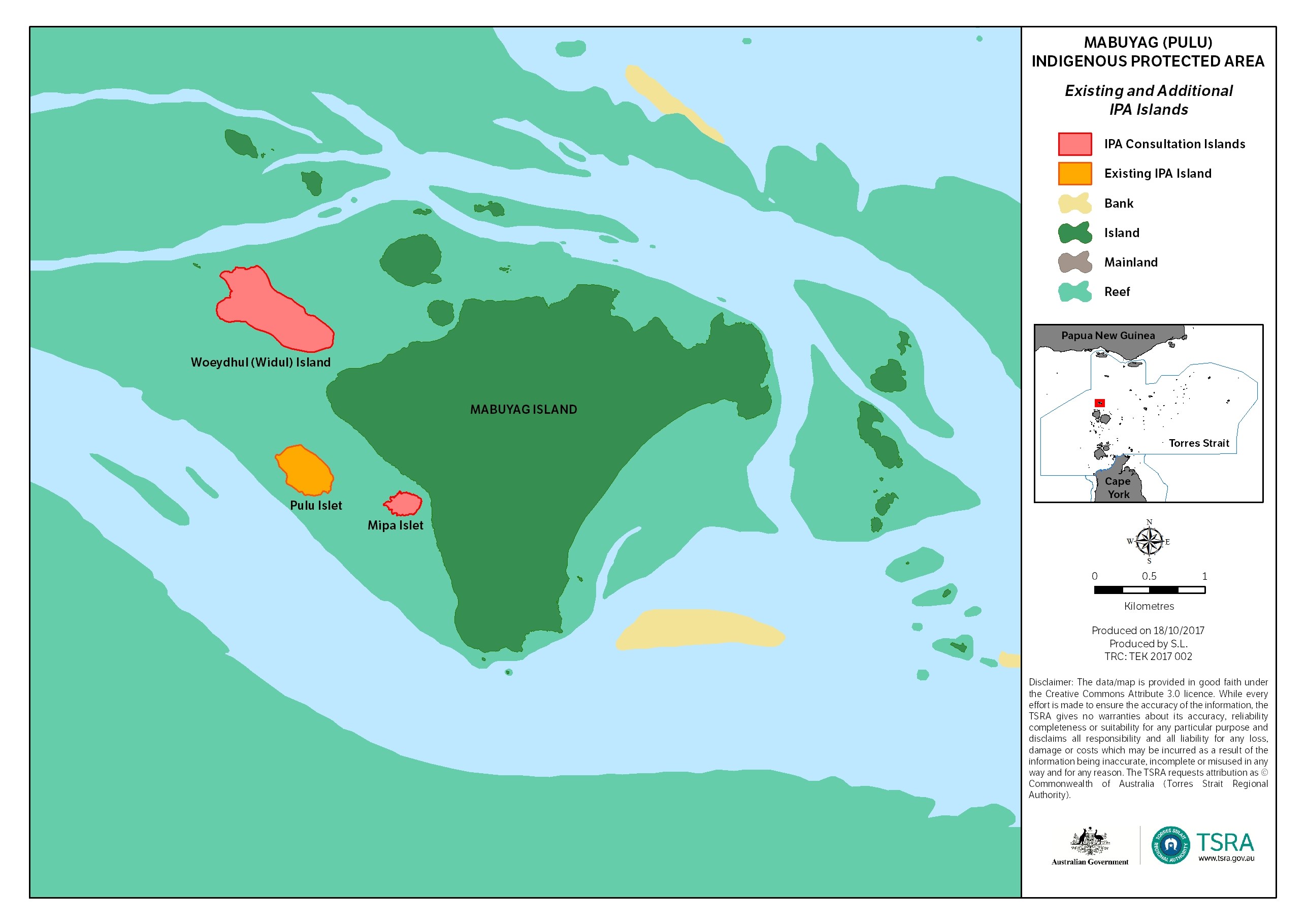
Lag Pulu (Pulu Islet) lies directly off the western side of Lag Mabuyag (Mabuyag Island). Goelmulgaw Traditional Owners are now planning to expand the Pulu IPA to include the nearby lagal (islands) of Woeydhul and Mipa.

Access to Pulu IPA
Lag Mabuyag (Mabuyag Island), Lag Pulu (Pulu Islet) and the surrounding lagal (islets) of Woeydhul and Mipa are recognised by Australian law as Goelmulgaw Moegi Kaywal (Goelmulgaw small islands)
Pulu is a culturally significant area so it is critical for visitors to obtain permission to visit these islands. Access to Pulu IPA will only be granted for research and education purposes at the discretion of the Kod and elders.
If you wish to visit the Pulu IPA, you must seek permission in writing from the Goelmulgaw Kod, the governing body for Pulu IPA. To seek permission please phone the Mabuygiw (Mabuyag) Rangers on (07) 4090 0949 or email here. The Mabuygiw (Mabuyag) Rangers will contact Goelmulgaw Kod and Goelmulgaw RNTBC on your behalf.
Once permission to visit is received, you must strictly abide by the Kod’s visitation protocols.